Spatial analysis
Calgary park access
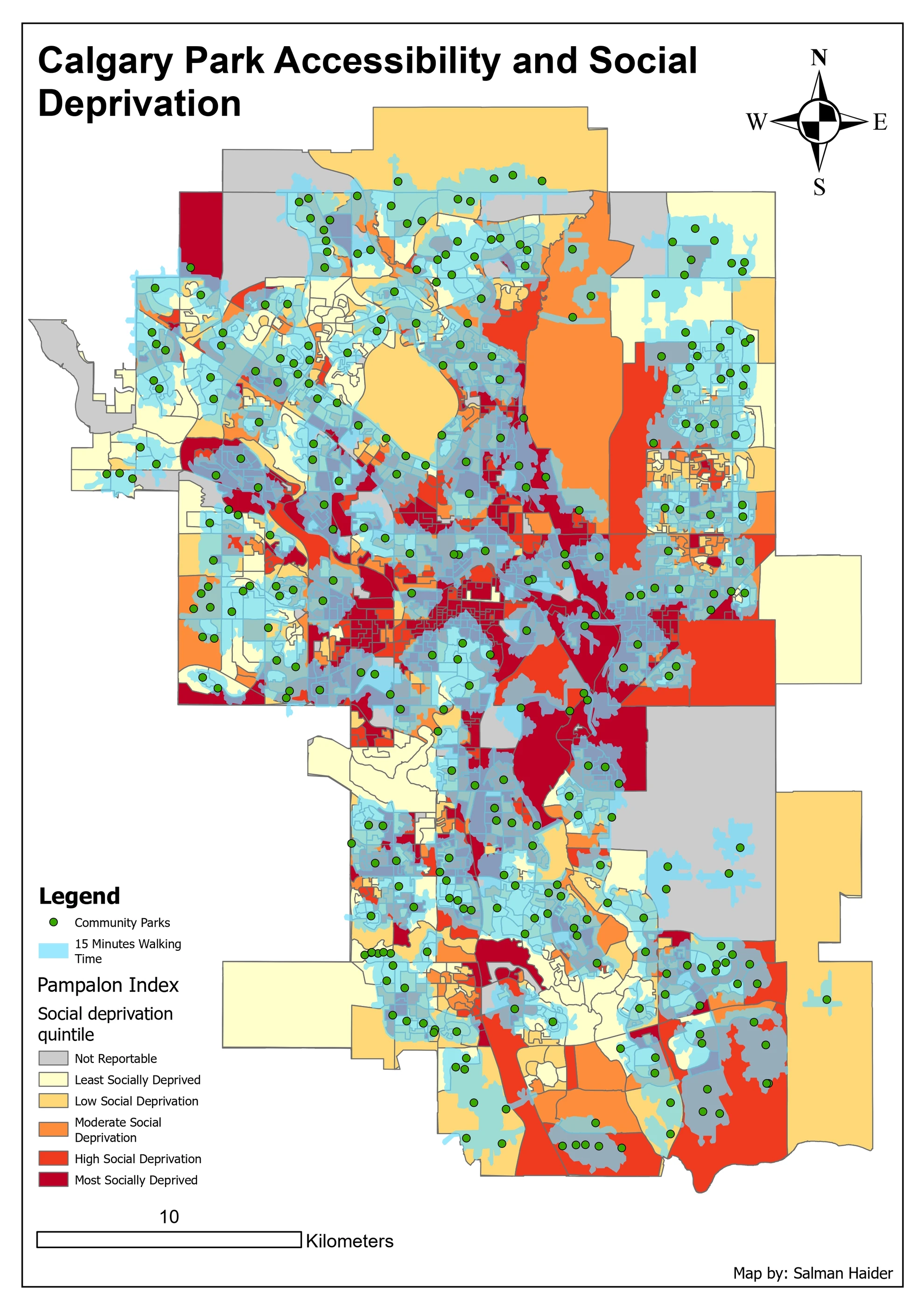
I examined who was outside a 15 minute walk from a community park and tested where one new park could help.
Read the project: Calgary park accessCanada
GIS Professional
I’ve worked on franchise territories, land records and public transit access, and built Python tools to automate GIS workflows. Here I’ve put together some of my maps and tools, with the questions, decisions and results behind them.

Spatial analysis
I examined who was outside a 15 minute walk from a community park and tested where one new park could help.
Read the project: Calgary park accessCode & tools
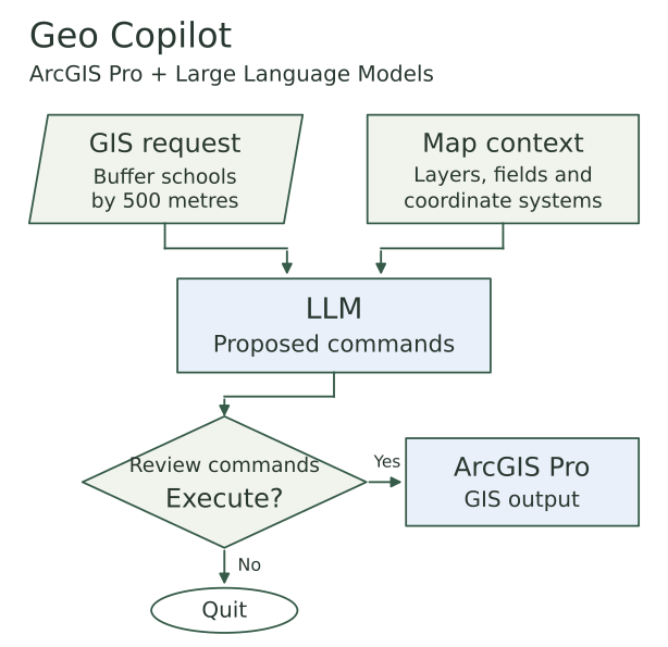
I built an ArcGIS Pro tool that uses Large Language Models (LLMs) to turn written requests into geoprocessing commands, with a review window before execution.
Read the project: Geo CopilotSpatial analysis
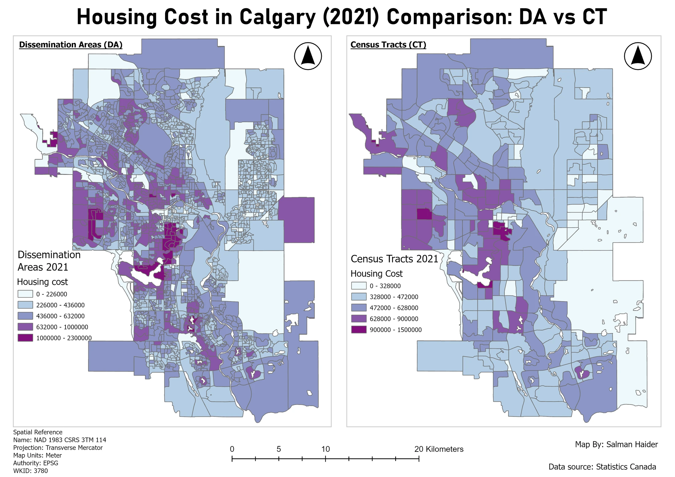
I compared Calgary housing costs and income across two census years to see where costs were highest and how geography affected the picture.
Read the project: Calgary housing patternsCode & tools
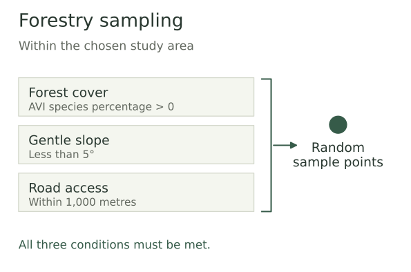
A field planning tool that generates candidate forest sampling points within a study area, using slope and road proximity criteria.
Read the project: Forestry Sampling Point GeneratorI worked on more than 105 territory projects, turning franchise requirements and demographic data into territories, maps and dashboards.
I used transit schedules and network analysis to examine access to fresh food across Calgary.
I worked with scanned land records, georeferencing and digitization, and used Python to help sort the records.
Outside work, I enjoy exploring new places and spending time outdoors. These are a few moments from walks, hikes and trips in British Columbia, Alberta and Pakistan.
A little more about me
I’m looking for GIS opportunities across Canada. You can reach me by email or on LinkedIn.